
Information about the city Huancavelica
Huancavelica (Spanish pronunciation: [waŋkaβeˈlika]) or Wankawilka in Quechua is a city in Peru. It is the capital of the Huancavelica region and according to the 2007 census had a population of 40,004 people (41,334 in the metropolitan area). The city was established on August 5, 1572 by the Viceroy of Peru Francisco de Toledo. Indigenous peoples represent a major percentage of the population. It has an approximate altitude of 3,660 meters; the climate is cold and dry between the months of February and August with a rainy season between September and January. It is considered one of the poorest cities in Peru.
The Huancavelica area features a rough geography with highly varied elevation, from 1,950 metres in the valleys to more than 5,000 metres on its snow-covered summits. These mountains contain metallic deposits. They consist of the western chain of the Andes, which includes the Chunta mountain range, formed by a series of hills, the most prominent of which are: Sitaq (5,328m), Wamanrasu (5,298m) and Altar (5,268m).
Among the rivers of the region there are the Mantaro, the Pampas, the Huarpa and the Churcampa. The Mantaro River penetrates Huancavelica, forming Tayacaja's Peninsula. Another river that shapes the relief is the Pampas River which is born in the lakes of the high mountains of Huancavelica, Chuqlluqucha and Urququcha.
Buses run from Huancavelica to Huancayo and Lima by a paved road. There is another road that connects it with the city of Pisco in the coast. Buses depart from the terminal terrestre located in the west side of the city.
Huancavelica is serviced by a train which runs between it and Huancayo known as "el Tren Macho". According to popular saying, this train “leaves when it wants and arrives when it can...”.
In 2009, the line between the break-of-gauge at Huancayo to Huancavelica was being converted from 914 mm (3 ft) gauge to 1,435 mm (4 ft 8 1⁄2 in) gauge. By October 2010 it was finished and it is now in service.
Information about the city Huarmey
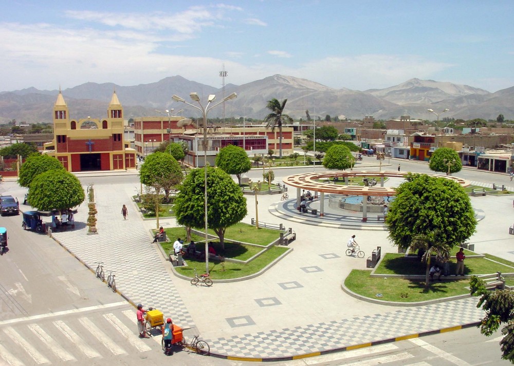
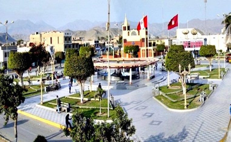
Huarmey is a coastal town in the Ancash Region, Peru. It is one of the five districts and also the capital of the Province of Huarmey. It is located crossing the Pan-American highway from south to north after leaving the department of Lima in Paramonga and at 82 km from the Fortaleza river. It was created by law 24034 on December 20, 1984.
At certain times of the year, the settlers fish abundant and flavorful shrimps in the Huarmey River. This river fertilizes the valley and flows from south to north.
The port of Huarmey is located at 5 km to the south, through a detour that begins in the Pan-American highway.
From Huarmey to the next important city, Casma, there are 83 km of distance.
This city is not very well developed yet, but it is one of the main cities of the Ancash Region and one of the most impressively attractive too. Huarmey has its own beautiful beaches that do not have anything to envy to the other beaches of the country. It is a very nice place to camp, practice surf or just take a refreshing splash in its beaches. The most important disadvantage is that the water is very cold, in spite of the high temperatures of the city, all the year round.
Huarmey is the site of the Punta Lobos massacre, a 14th-century pre-Columbian Chimú human sacrifice and mass burial site.