
Information about the city Juliaca
Juliaca is the capital of San Roman Province in the Puno Region of southeastern Peru. It is the region's largest city with a population of 225,146 inhabitants (2007). On the Altiplano, Juliaca is 3,825 metres (12,549 ft) above sea level, is located on the Collao Plateau and is northwest of Lake Titicaca (45 km). It is the largest trade center in the Puno region. Juliaca is near Chacas lagoon, the Maravillas river, and near the ruins of Sillustani. The city hosts Juliaca's Carnival each year between February and March. During this very popular event participants, dressed in colorful costumes, gather on the streets to dance in the style of the Collao Plateau. Saint Sebastian's feast occurs on January 20 of every year. Juliaca's citizens rely on cars, trains, and bicycles. It is a major transit point in the region and has strong ties with Peru's southern cities, including Arequipa, Puno, Tacna, Cuzco, Ilo, and with La Rinconada and Bolivia. Like Chicago, Illinois, it is nicknamed "The Windy City", because of the city's location on the windy Collao Plateau. It is also called the "Sock City" or "Knitting City" because Juliaca was a major center of sock, sweater, and handicraft production. Now the production of clothes, wool and fabrics are industrial processes. Juliaca has a subtropical highland climate (Köppen Cwb) bordering on an alpine tundra climate with cool to cold temperatures most of the year. The average annual precipitation is 610 mm. Winters are dry with very cold nights and mornings, and warm afternoons.
Information about the city Arequipa
Tickets to Arequipa on recorrido.pe
|
Route |
Bus company |
Price |
Departure times |
|
Lima a Arequipa |
Movil Bus |
S/ 90 |
15:00 15:30 16:00 16:30 |
|
Lima a Arequipa |
Cromotex |
S/ 100 |
13:00 14:30 17:00 18:00 19:00 20:00 21:00 |
| Lima a Arequipa | TEPSA | S/ 110 | 14:00 15:00 15:35 19:15 20:30 21:00 |
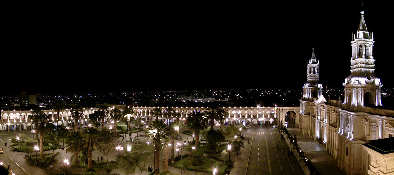
Arequipa is the capital and largest city of the Arequipa Region and the seat of the Constitutional Court of Peru. It is Peru's second most populous city with 861,145 inhabitants, as well as its second most populous metropolitan area as of 2016, according to the National Institute of Statistics and Informatics (INEI).
Arequipa is the second most industrialized and commercialized city in Peru. Its industrial activity includes manufactured goods and camelid wool products for export. The city has close trade ties with Chile, Bolivia and Brazil.
The city was founded on 15 August 1540, by Garcí Manuel de Carbajal as "Villa Hermosa de Nuestra Señora de la Asunción". During the Colonial period, Arequipa became highly important for its economic prosperity[4] and for its loyalty to the Spanish Crown.
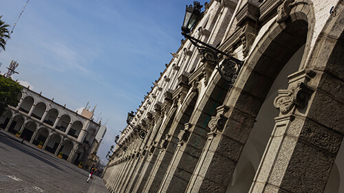
After Peru gained its independence from Spain in 1821, Arequipa acquired greater political significance, and was declared the capital city of Peru from 1835 to 1883. The historic center of Arequipa spans an area of 332 hectares and is a UNESCO World Heritage Site. Its historic heritage, natural scenery and cultural sites make the city a major tourist destination. Its religious, colonial, and republican architectural styles blend European and native characteristics into a unique style called "Escuela Arequipeña".
In Arequipa, tourism is an important boost for the local economy, as the city is the third most visited city in the country after Cusco and Lima. In 2010, Arequipa received a total of 1.395 million visitors according to the Ministry of Commerce and Tourism.
Terrapuerto Internacional Arequipa is a bus terminal located in the district of Jacobo Hunter. There, several bus companies offer land travel routes to regional and national destinations within Peru and to international destinations such as La Paz, Santiago de Chile, Mendoza and Buenos Aires.