
Information about the city Paita
Paita is a city in northwestern Peru. It is the capital of the Paita Province which is in the Piura Region. It is a leading seaport in that region. It is located 1,089 km northwest of the country's capital Lima and 57 km northwest of the regional capital of Piura. Starting in 2014, it has entertained ideas for the separation Paita from Piura Region, proclaiming itself "Miguel Grau region".
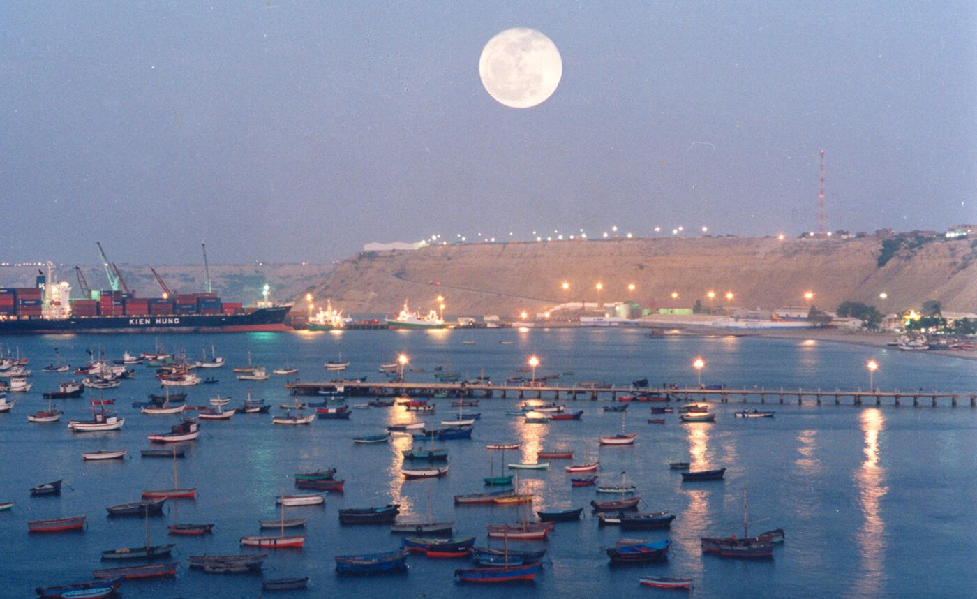
The seaport city Paita is located at WikiMiniAtlas05°05′28″S 81°06′23″W on a small peninsula south of the mouth of the Río Chira on an area of 1,785 km². Paita faces on the Bay of Paita, and is sheltered from southerly winds by a headland called Punta Paita and by a large hill called Silla de Paita. 90 km to the south east is the capital of the Piura Region, Piura, and 160 km to the south is located Chiclayo, commercial centre of the Lambayeque region.
In 1875, a railway line of 97 km length was completed from Piura to Paita, but it was destroyed in the war with Chile from 1879 to 1883 and reconstructed in 1884. A street railway opened on 30 August 1891 and ran until the late 1920s.
Today the port of Paita is Peru's fifth largest port and an important container port. It is located in a geopolitically important position on the Pacific coast.
Paita has one of the best natural harbours of the Peruvian coast and runs regular mail steamers between Valparaíso and Panama.
Information about the city Moquegua
Moquegua, founded by the Spanish colonists as Villa de Santa Catalina de Guadalcázar del Valle de Moquegua) is a city in southern Peru, located in the Moquegua Region, of which it is the capital. It is also capital of Mariscal Nieto Province and Moquegua District. It is located 1144 kilometers south of the capital city of Lima.
This region was occupied for thousands of years by successive cultures of indigenous peoples. The Wari culture built numerous monuments, and developed terraced fields to support crop cultivation on hillsides hundreds of years before the Inca conquered them and expanded their territory into this area. Cerro Baúl is the remains of a Wari monumental site, on top of a hill outside of Moquegua.
According to Inca Garcilaso de la Vega, the Inca Emperor Mayta Cápac organized the military expedition that extended the Inca domains to the shore of the Pacific. They overcame other indigenous peoples in the 15th century; in the next century, they were conquered by the Spanish.
There is no definite information about the year of the city's founding by the Spanish. Tradition holds that the colonial city was founded on November 25, 1541, by Pedro Cansino and his wife Josefina de Bilbao.
Moquegua's economy is largely based on mining. Resources include copper, silver, gold and molybdenum. Cuajone and part of Toquepala Mine are located in the Mcal. Nieto Province. A copper smelter and refinery to treat copper concentrates from those mines is located in Ilo province.