Information about the city Ancash
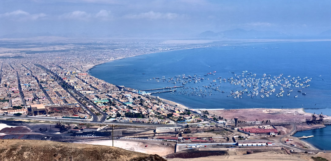
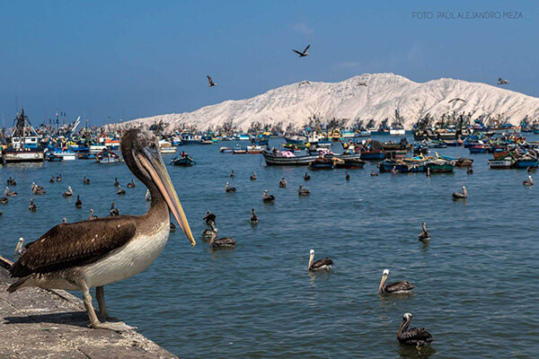
Ancash is a region of northern Peru. It is bordered by La Libertad Region on the north, Huánuco and Pasco regions on the east, the Lima Region on the south, and the Pacific Ocean on the west. Its capital is the city of Huaraz, and its largest city and port is Chimbote. The name of the region originates from the Quechua word anqash (light, of little weight), from anqas (blue) or from anka (eagle). Ancash is a land of contrasts: it features two great longitudinal valleys, which combine the mountain characteristics of the Callejón de Huaylas (Alley of Huaylas) with the sylvan ones of the Alto Marañón. Miles of sandy beaches and the blue waters of the Pacific. The territory of the coast, high plateaux and Andean punas of the Ancash Region are flat, while the rest of the territory, in the Andes, is very rough. In the west, slopes with strong declivity form narrow canyons with abrupt and deserted sides. The rough territory of the region is crossed by two mountain ranges: on the western side, the Cordillera Negra (Spanish for "black mountain range"), which has peaks without glaciers, and on the eastern side, the Cordillera Blanca ("white mountain range"), which has many peaks covered with snow and ice, such as the Huascarán and the Alpamayo. Between these two mountain ranges, the Santa River flows through the so-called Callejón de Huaylas. This valley narrows to form the Cañón del Pato ("duck canyon"). Also along the Pacific slopes, the Santa River has shaped a wide valley in the punas which narrows into the Cordillera Negra, where the Cañón del Pato canyon was formed. The snow-covered peak of Huascarán, highest peak of Peru and second of the Americas, reaches a height of 6,768 m (22,205 ft, 4.2 miles) and contrasts with the 6,263 m (20,548 ft) deep trough of Chimbote found in the ocean west of Ancash. Remnants of glaciers created many lakes such as Llanganuco Lakes and Lake Parón. Following the Pan-American Highway north from Lima, the territory of the region of Ancash begins just beyond the Fortress of Paramonga, between wide fields of sugarcane, and across the Fortaleza River, 206 kilometres (128 mi) from Lima. Along the coast of Ancash, from the Fortaleza River to the Santa River, the Pacific exerts great influence. The Peruvian current and the El Niño current exert considerable and sometimes tragic effect on local lives and regional economies. Normally, the Peruvian current, also known as the Humboldt Current, brings cold water and large numbers of fish. With the development of the shoals of anchoveta, the Ancash ports and creeks became commercial fishing centers. During the 1950s, the bay of Chimbote was the top fishing port of the world. However, when warmer waters from the north, such as the current of El Niño, bring catastrophic rains to the coast and sea, the shoals of anchoveta disappear, leaving the fishing fleets plants paralyzed, and flooding rivers cause serious damage to the lands and cities. The cycles of these two sea currents that affect Peru are hard to predict. Further north along the Pan-American highway, numerous islands and islets dot the sea near the coast. Most are home only to guano seabirds. From south to north, the most important islands include Tortuga Island (Turtle Island), La Viuda Island (The Widow Island), Isla Blanca (White Island) and Santa Island (Holy Island). The coastal region of Peru includes many peninsulas, creeks, warm bays and sand beaches, full of color. Because of the lack of roads and difficult terrain, many of these are inaccessible by land. The most important beaches include Grande Beach, La Gramita Beach and Las Salinas Beach. Much of this coast is a monotonous stretch of huge sand deserts, a common denominator in all Peruvian coastal regions because of the influence of the Humboldt Current. Along the rivers, there are green valleys, cultivated mainly with sugarcane, rice and cotton. From south to north, the main rivers of the Ancash coast are the following: Huarmey, Culebras, Casma, Sechín, Nepeña, Lacramarca and Santa. Of these rivers, the only one with water year-round is the Santa River. Its sources are the glaciers and lakes of the Cordillera Blanca. The other rivers, as with most rivers of the Peruvian coast, are intermittent, depending on the highland rains or the advance of El Niño.
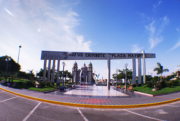
Information about the city Chimbote
Chimbote is the largest city in the Ancash Region of Peru, and the capital of both Santa Province and Chimbote District.
The city is located on the coast in Chimbote Bay, 130 km south of Trujillo and 420 kilometers (260 mi) north of Lima on the North Pan-American highway. It is the start of a chain of important cities on the Peruvian north coast like Trujillo, Chiclayo and Piura. The advantages of this geographic location made Chimbote into a transshipment junction for the Santa River valley.
In 1835, when General Santa Cruz granted Chimbote's first official acknowledgement, Chimbote was a village of fishermen with a population of no more than 800.
In 1871, an agreement was made with Henry Meiggs to build a railroad towards the interior of the country. Chimbote was classified as a port, even though its population remained around 1,000. The opening of the Pan-American Highway created easy access to Lima in the 1930s. In 1881, there was an attempt to cede a naval base to the U.S. in Chimbote Bay by Peru. The deal was blocked by Chile who sent its marines to occupy Chimbote after learning of the deal to cede a naval base to the U.S. Navy.
In 1940, Chimbote was still a small fishing port, with only 2,400 inhabitants in an urbanized area of 80 hectares (0.80 km2; 0.31 sq mi). In 1943, the government created the Corporación Peruana del Santa (Peruvian Corporation of Santa). This entity assumed ownership of the railroad, made improvements to the port, and began work on a hydroelectric power station on the Río Santa (in the Cañón del Pato [Duck Canyon] in Huallanca). The first stage of the power station was inaugurated in 1958; also that year, an iron and steel plant was built. By 1943, the first companies dedicated to the extraction of liver from the Pacific bonito fish arrived. This liver was sold for a high price abroad due to World War II.