Information about the city Azángaro
Azángaro is a town in Southern Peru, capital of the province Azángaro in the region of Puno.[1] The colonial church in Azangaro is known as the golden temple. In the adjacent Plaza San Bernardo, Pedro Vilca Apaza was drawn and quartered for his role as a General in Tupac Amaru II's attempt to liberate Perú from the Spanish government. His last words were, "Por este Sol aprended a morir como yo." After Tupac Amaru II's execution, leadership of the revolution shifted to Azangaro. The church bell tower, an example of colonial decorative adobe, was much disfigured by rains before recent rains caused a collapse of most of the tower. The gold interior is a magnificent example of rich colonial art. Recently, colonial treasures were robbed from the church. Azángaro was "discovered" by Captain Don Manuel Ortiz Aguilar on November 1535. The priest Rodrigo Chrysostom, overseer of the Doctrine of baptism of the Collao Indians in 1535, is the first to report on the existence Azángaro, which was located in the place called Macaya and there an idol of a cat whose eyes were rubies was worshiped. When Christians brought indoctrination to this place, the doctrine of "Our Lady of the Rosary" was founded and a small church was built in the orders of the Dominico Father Tomas de San Martin and Acosta (the same who founded the University of San Marcos) and cacique Fabian Mango. The arrival of the Spanish in Azángaro occurs in 1535. In 1542 the Viceroyalty of Peru covering 3 states are created: Lima, La Plata and Chile, this time Azángaro and Puno belong to this Viceroyalty. Already in the Republican Era, in 1825, by the law of February 5 Azángaro is elevated to city status. In 1825, by the law of June 21 Azángaro was created as the capital of the province of the same name with its 18 districts: Achaya, Arapa, Asillo, Caminaca, Azángaro, etc. The economy is based primarily on Azángaro's development of livestock production activities, supplemented by agriculture, crafts, trade in agricultural products, consumer goods and non-regional transportation services. No figures are available regarding the provincial gross domestic product, but it is known that animal exploitation is the largest contributor to the economy by raising cattle, sheep and alpacas, which generate end products such as milk, wool, skins and meat for consumption; also products are obtained for transformation, such as milk for processing into cheese, yogurt for human consumption, sheep, alpaca and llama wool and cow leather.
Information about the city Paita
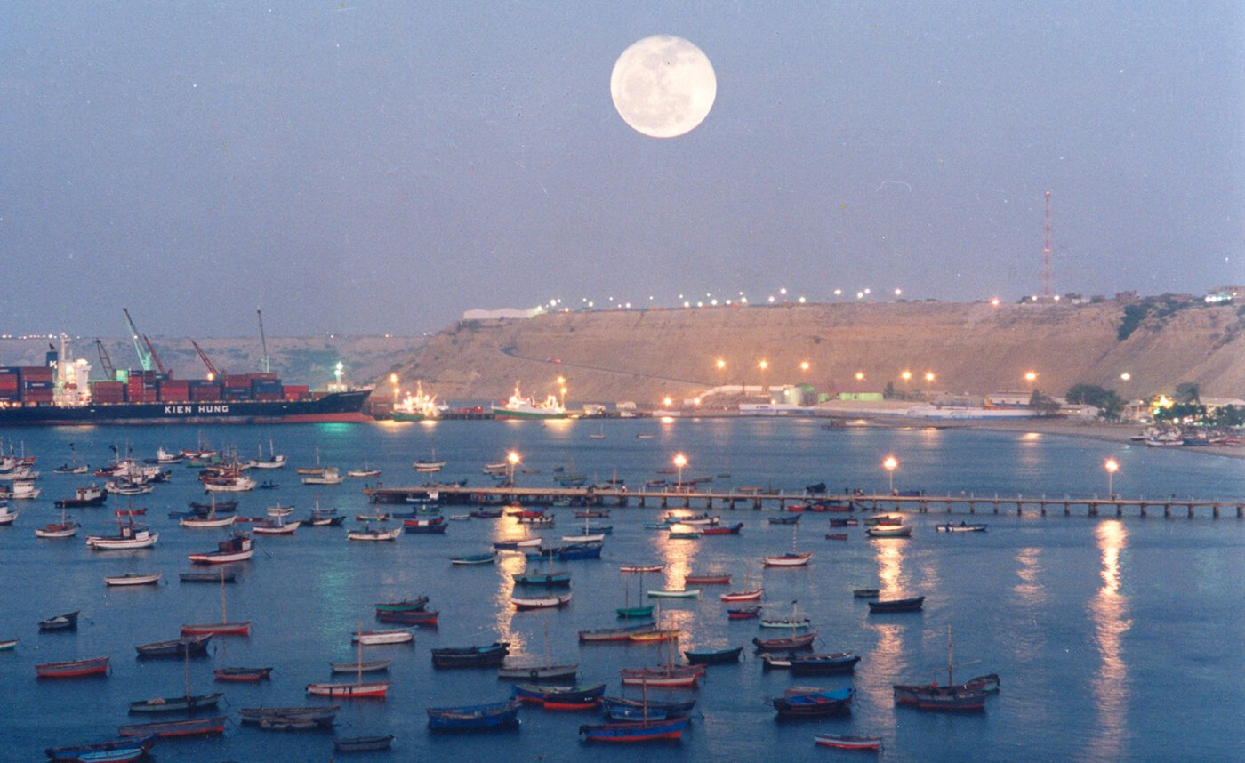
Paita is a city in northwestern Peru. It is the capital of the Paita Province which is in the Piura Region. It is a leading seaport in that region. It is located 1,089 km northwest of the country's capital Lima and 57 km northwest of the regional capital of Piura. Starting in 2014, it has entertained ideas for the separation Paita from Piura Region, proclaiming itself "Miguel Grau region".
The seaport city Paita is located at WikiMiniAtlas05°05′28″S 81°06′23″W on a small peninsula south of the mouth of the Río Chira on an area of 1,785 km². Paita faces on the Bay of Paita, and is sheltered from southerly winds by a headland called Punta Paita and by a large hill called Silla de Paita. 90 km to the south east is the capital of the Piura Region, Piura, and 160 km to the south is located Chiclayo, commercial centre of the Lambayeque region.
In 1875, a railway line of 97 km length was completed from Piura to Paita, but it was destroyed in the war with Chile from 1879 to 1883 and reconstructed in 1884. A street railway opened on 30 August 1891 and ran until the late 1920s.
Today the port of Paita is Peru's fifth largest port and an important container port. It is located in a geopolitically important position on the Pacific coast.
Paita has one of the best natural harbours of the Peruvian coast and runs regular mail steamers between Valparaíso and Panama.