Information about the city Huacho
Huacho is a city in Peru, capital of the Huaura Province and capital of the Lima Region. It is located 223 feet (67 metres) above sea level and 148 km north of the city of Lima. The city is located on the Pan-American Highway, and close to the Lomas de Lachay National Park so it has extensive vegetation and wildlife.
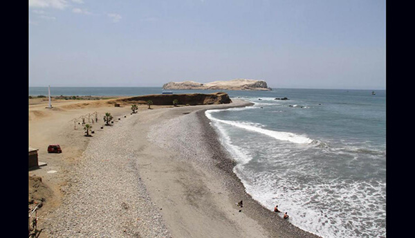
Settled on the bottom of a wide bay, its climate is wet and appealing. In the surrounding areas there are rice, cotton, sugarcane and different grain fields. This fact has allowed the rise of a rather important cotton industry, as well as cotton and oil factories. Within its natural landscape, its salt mines and its beaches (such as El Paraíso ) are of great interest. Huacho was one of the main trade centers of northern Lima.
Under the viceroy of Francisco de Toledo, who decided to group the ayllus of the Indians who were established in that area into reductions. The site chosen was that of "Gaucho Bay." Consequently, on 25 August 1571, the reduction was named San Bartolomé de Guachu.
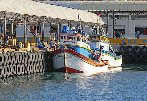
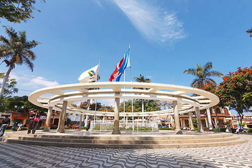
During the Viceroyalty of Peru, the city belonged to the province of Huara and was established as a trading and fishing port. In 1774 the Viceroy José Antonio de Mendoza granted Huacho the category of "pueblo" and with it, allowed it to build its main plaza.
Huacho was, like Huaura, a pueblo that received and hosted the members of the liberation expedition led by José de San Martín, participating on 26 November 1820 of the Grito libertador en el balcéon de Huaura, on the subject of historical verification.
On 12 February 1821, Huacho was elevated to district, belonging to the province of Chanchay, in the department of Lima. The Congress conceded the titale of Fidelísima Villa (most faithful) on 11 April 1828, under the presidency of Don José de La Mar. On 24 January 1830, the province of Chanchay was unified with the province of Lima and Santa in the department of Ancash. Huaura was established as the capital of the province of Chanchay. Thirty years before, on January 23, 1866, Huacho was established as the capital of Chanchay.
Due to its technological advances, in 1892, the city began a city tram service, an animal transportation service called "tranvías de sangre" (blood tram), which was said to have used mules or horses. This service extended to Huara, and was electrified in 1920, making Huacho the first city after Lima to have its own electric tram system.
Beginning in 1911, it was the main hub of the Ferrocarril Noroeste del Perú (Northwestern Train of Peru), which connected Huacho with Ancón, Sayan, and Barranca.
On November 10, 1874, Huacho was elevated to the category of city and was made capital of the province even when it was separated from Chanchay (today the province of Huaral), and the province of Huaura was created. Actually, the city of Huacho was also the capital of the Governal Region of Lima.
Information about the city Ancash
Ancash is a region of northern Peru. It is bordered by La Libertad Region on the north, Huánuco and Pasco regions on the east, the Lima Region on the south, and the Pacific Ocean on the west. Its capital is the city of Huaraz, and its largest city and port is Chimbote. The name of the region originates from the Quechua word anqash (light, of little weight), from anqas (blue) or from anka (eagle). Ancash is a land of contrasts: it features two great longitudinal valleys, which combine the mountain characteristics of the Callejón de Huaylas (Alley of Huaylas) with the sylvan ones of the Alto Marañón. Miles of sandy beaches and the blue waters of the Pacific. The territory of the coast, high plateaux and Andean punas of the Ancash Region are flat, while the rest of the territory, in the Andes, is very rough. In the west, slopes with strong declivity form narrow canyons with abrupt and deserted sides. The rough territory of the region is crossed by two mountain ranges: on the western side, the Cordillera Negra (Spanish for "black mountain range"), which has peaks without glaciers, and on the eastern side, the Cordillera Blanca ("white mountain range"), which has many peaks covered with snow and ice, such as the Huascarán and the Alpamayo. Between these two mountain ranges, the Santa River flows through the so-called Callejón de Huaylas. This valley narrows to form the Cañón del Pato ("duck canyon"). Also along the Pacific slopes, the Santa River has shaped a wide valley in the punas which narrows into the Cordillera Negra, where the Cañón del Pato canyon was formed. The snow-covered peak of Huascarán, highest peak of Peru and second of the Americas, reaches a height of 6,768 m (22,205 ft, 4.2 miles) and contrasts with the 6,263 m (20,548 ft) deep trough of Chimbote found in the ocean west of Ancash. Remnants of glaciers created many lakes such as Llanganuco Lakes and Lake Parón. Following the Pan-American Highway north from Lima, the territory of the region of Ancash begins just beyond the Fortress of Paramonga, between wide fields of sugarcane, and across the Fortaleza River, 206 kilometres (128 mi) from Lima. Along the coast of Ancash, from the Fortaleza River to the Santa River, the Pacific exerts great influence. The Peruvian current and the El Niño current exert considerable and sometimes tragic effect on local lives and regional economies. Normally, the Peruvian current, also known as the Humboldt Current, brings cold water and large numbers of fish. With the development of the shoals of anchoveta, the Ancash ports and creeks became commercial fishing centers. During the 1950s, the bay of Chimbote was the top fishing port of the world. However, when warmer waters from the north, such as the current of El Niño, bring catastrophic rains to the coast and sea, the shoals of anchoveta disappear, leaving the fishing fleets plants paralyzed, and flooding rivers cause serious damage to the lands and cities. The cycles of these two sea currents that affect Peru are hard to predict. Further north along the Pan-American highway, numerous islands and islets dot the sea near the coast. Most are home only to guano seabirds. From south to north, the most important islands include Tortuga Island (Turtle Island), La Viuda Island (The Widow Island), Isla Blanca (White Island) and Santa Island (Holy Island). The coastal region of Peru includes many peninsulas, creeks, warm bays and sand beaches, full of color. Because of the lack of roads and difficult terrain, many of these are inaccessible by land. The most important beaches include Grande Beach, La Gramita Beach and Las Salinas Beach. Much of this coast is a monotonous stretch of huge sand deserts, a common denominator in all Peruvian coastal regions because of the influence of the Humboldt Current. Along the rivers, there are green valleys, cultivated mainly with sugarcane, rice and cotton. From south to north, the main rivers of the Ancash coast are the following: Huarmey, Culebras, Casma, Sechín, Nepeña, Lacramarca and Santa. Of these rivers, the only one with water year-round is the Santa River. Its sources are the glaciers and lakes of the Cordillera Blanca. The other rivers, as with most rivers of the Peruvian coast, are intermittent, depending on the highland rains or the advance of El Niño.