Information about the city Huancavelica
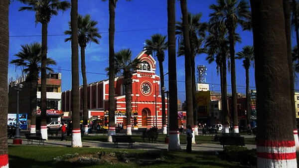
Huancavelica (Spanish pronunciation: [waŋkaβeˈlika]) or Wankawilka in Quechua is a city in Peru. It is the capital of the Huancavelica region and according to the 2007 census had a population of 40,004 people (41,334 in the metropolitan area). The city was established on August 5, 1572 by the Viceroy of Peru Francisco de Toledo. Indigenous peoples represent a major percentage of the population. It has an approximate altitude of 3,660 meters; the climate is cold and dry between the months of February and August with a rainy season between September and January. It is considered one of the poorest cities in Peru.
The Huancavelica area features a rough geography with highly varied elevation, from 1,950 metres in the valleys to more than 5,000 metres on its snow-covered summits. These mountains contain metallic deposits. They consist of the western chain of the Andes, which includes the Chunta mountain range, formed by a series of hills, the most prominent of which are: Sitaq (5,328m), Wamanrasu (5,298m) and Altar (5,268m).
Among the rivers of the region there are the Mantaro, the Pampas, the Huarpa and the Churcampa. The Mantaro River penetrates Huancavelica, forming Tayacaja's Peninsula. Another river that shapes the relief is the Pampas River which is born in the lakes of the high mountains of Huancavelica, Chuqlluqucha and Urququcha.
Buses run from Huancavelica to Huancayo and Lima by a paved road. There is another road that connects it with the city of Pisco in the coast. Buses depart from the terminal terrestre located in the west side of the city.
Huancavelica is serviced by a train which runs between it and Huancayo known as "el Tren Macho". According to popular saying, this train “leaves when it wants and arrives when it can...”.
In 2009, the line between the break-of-gauge at Huancayo to Huancavelica was being converted from 914 mm (3 ft) gauge to 1,435 mm (4 ft 8 1⁄2 in) gauge. By October 2010 it was finished and it is now in service.
Information about the city Chincha
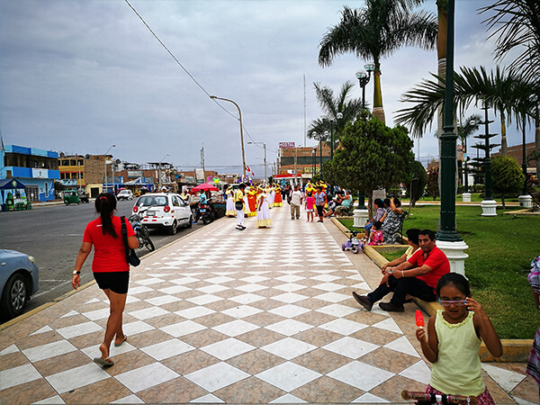
Chincha Alta is a Peruvian city located in the Ica Region. It is the capital of Chincha Province. The City of Chincha Alta is located 200 kilometers south of Lima, in the Chincha Province of the Ica Region of Peru. The city covers an area of 2988 km² and has a population of 56,085.
Pre-Chincha era
The first inhabitants of the area arrived at the beginning of the ninth century. These people are known as the "Pre-Chincha". The historian Luis Cánepa Pachas puts the date of the arrival of the Pre-Chincha at sometime in the tenth century. The rudimentary Pre-Chincha culture was centered on fishing and shell gathering. The origin of the Pre-Chincha people is still uncertain.
Chincha era
In the eleventh century, a more advanced and warlike people known as the Chincha arrived in the coastal area. The Chincha had developed systems of architecture, agriculture and irrigation. The Chincha came to dominate the original inhabitants of the area. Some aspects of the original Pre-Chincha culture were absorbed by the newcomers. The word Chincha is derived from "Chinchay" or "Chinchas" or "Cinca" which mean "jaguar" in Chincha Quechua. The Chincha worshiped a jaguar god, and believed themselves to be descended from jaguars, who gave them their warlike and dominating tendencies. The Chincha fertilized their fields with dead birds and guano, and this knowledge was passed on to later peoples. The Chincha learned seafaring skills from the Pre-Chincha, and may have traveled as far as Central America by boat.