Information about the city Huancayo
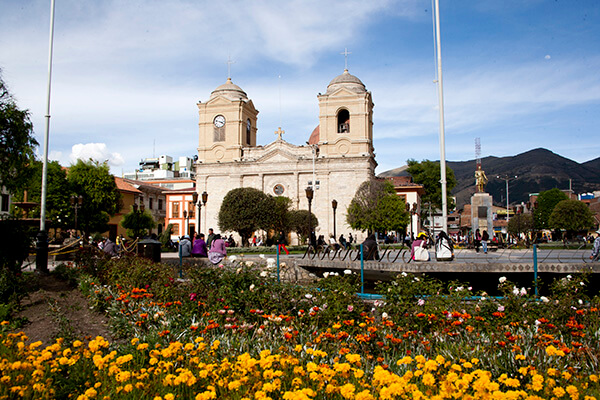
Huancayo is the capital of Junín Region, in the central highlands of Peru. Huancayo is located in Huancayo Province, of which it is also the capital. Situated in the Mantaro Valley at an altitude of 3,271 meters, it belongs to the Quechua region. Depending on delimitation, the agglomeration has a population between 340,000 and 380,000 and is the fifth most populous city of the country. Huancayo is the cultural and commercial center of the whole central Peruvian Andes area.
According to the National Census of 2007 the three main districts of Huancayo have a total population of about 340,000. However, the continuous settlement area have already reached periurban districts, resulting in the agglomeration's population to be at least 380,000 people. Amerindian and Mestizos (Amerindian and Spanish ancestry) are the two largest ethnic groups in the city. Asian (mainly descendants of Japanese and Chinese immigrants) and European descendants are important minority groups.
Huancayo has transportation connections by air, road and rail. The Francisco Carle Airport at Jauja offers daily connections to Lima and is located 45 minutes via car from Huancayo. Current airlines include LATAM Peru, LC Peru, and Peruvian Airlines. To travel by road, the Carretera Central links Huancayo with La Oroya and Lima, which generally takes 7 to 8 hours. Multiple bus carriers operate between Lima and Huancayo daily. The Ferrocarril Central Andino enables transport by rail. Huancayo was a break-of-gauge from 914 mm (3 ft) gauge to 1,435 mm (4 ft 8 1⁄2 in) gauge; for the 147 km extension to Huancavelica. In 2009, this line was being standardized.
Information about the city Cusco
Cusco is a city in southeastern Peru, near the Urubamba Valley of the Andes mountain range. It is the capital of the Cusco Region as well as the Cusco Province. In 2013, the city had a population of 435,114. Located on the eastern end of the Knot of Cuzco, its elevation is around 3,400 m (11,200 ft). The site was the historic capital of the Inca Empire from the 13th until the 16th-century Spanish conquest. In 1983 Cusco was declared a World Heritage Site by UNESCO. It has become a major tourist destination, hosting nearly 2 million visitors a year. The Constitution of Peru designates it as the Historical Capital of Peru.
Cusco extends throughout the Huatanay (or Watanay) river valley. Located on the eastern end of the Knot of Cusco, its elevation is around 3,400 m (11,200 ft). To its north is the Vilcabamba mountain range with 4,000–6,000-metre-high (13,000–20,000-foot) mountains. The highest peak is Salcantay (6,271 metres or 20,574 feet) about 60 kilometres (37 miles) northwest of Cusco.[23]
Cusco has a subtropical highland climate (Köppen Cwb). It is generally dry and temperate, with two defined seasons. The dry season lasts from May to August, with abundant sunshine and occasional nighttime freezes; July is the coolest month with an average of 9.7 °C (49.5 °F). The wet season lasts from December to March, with night frost less common; November averages 13.3 °C (55.9 °F). Although frost and hail are common, the only snowfall ever recorded was in June 1911. Temperatures usually range from 0.2 to 20.9 °C (32.4 to 69.6 °F), but the all-time temperature range is between −8.9 and 30 °C (16.0 and 86.0 °F). Sunshine hours peak in July; the equivalent of January in the northern hemisphere. In contrast, February, the equivalent of August in the northern hemisphere, has the least amount of sunshine.
Tourism has been the backbone of the economy starting in the early 2000s, bringing in more than 1.2 million tourists per year. In 2002, the income Cusco received from tourism was $837 million USD. In 2009, that number increased to $2.47 billion USD.