Information about the city Huancayo
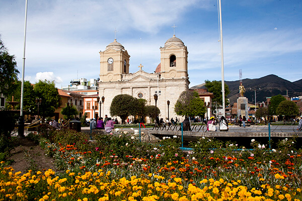
Huancayo is the capital of Junín Region, in the central highlands of Peru. Huancayo is located in Huancayo Province, of which it is also the capital. Situated in the Mantaro Valley at an altitude of 3,271 meters, it belongs to the Quechua region. Depending on delimitation, the agglomeration has a population between 340,000 and 380,000 and is the fifth most populous city of the country. Huancayo is the cultural and commercial center of the whole central Peruvian Andes area.
According to the National Census of 2007 the three main districts of Huancayo have a total population of about 340,000. However, the continuous settlement area have already reached periurban districts, resulting in the agglomeration's population to be at least 380,000 people. Amerindian and Mestizos (Amerindian and Spanish ancestry) are the two largest ethnic groups in the city. Asian (mainly descendants of Japanese and Chinese immigrants) and European descendants are important minority groups.
Huancayo has transportation connections by air, road and rail. The Francisco Carle Airport at Jauja offers daily connections to Lima and is located 45 minutes via car from Huancayo. Current airlines include LATAM Peru, LC Peru, and Peruvian Airlines. To travel by road, the Carretera Central links Huancayo with La Oroya and Lima, which generally takes 7 to 8 hours. Multiple bus carriers operate between Lima and Huancayo daily. The Ferrocarril Central Andino enables transport by rail. Huancayo was a break-of-gauge from 914 mm (3 ft) gauge to 1,435 mm (4 ft 8 1⁄2 in) gauge; for the 147 km extension to Huancavelica. In 2009, this line was being standardized.
Information about the city Juliaca
Juliaca is the capital of San Roman Province in the Puno Region of southeastern Peru. It is the region's largest city with a population of 225,146 inhabitants (2007). On the Altiplano, Juliaca is 3,825 metres (12,549 ft) above sea level, is located on the Collao Plateau and is northwest of Lake Titicaca (45 km). It is the largest trade center in the Puno region. Juliaca is near Chacas lagoon, the Maravillas river, and near the ruins of Sillustani. The city hosts Juliaca's Carnival each year between February and March. During this very popular event participants, dressed in colorful costumes, gather on the streets to dance in the style of the Collao Plateau. Saint Sebastian's feast occurs on January 20 of every year. Juliaca's citizens rely on cars, trains, and bicycles. It is a major transit point in the region and has strong ties with Peru's southern cities, including Arequipa, Puno, Tacna, Cuzco, Ilo, and with La Rinconada and Bolivia. Like Chicago, Illinois, it is nicknamed "The Windy City", because of the city's location on the windy Collao Plateau. It is also called the "Sock City" or "Knitting City" because Juliaca was a major center of sock, sweater, and handicraft production. Now the production of clothes, wool and fabrics are industrial processes. Juliaca has a subtropical highland climate (Köppen Cwb) bordering on an alpine tundra climate with cool to cold temperatures most of the year. The average annual precipitation is 610 mm. Winters are dry with very cold nights and mornings, and warm afternoons.