Information about the city Huancayo
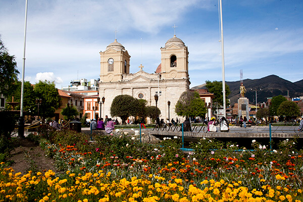
Huancayo is the capital of Junín Region, in the central highlands of Peru. Huancayo is located in Huancayo Province, of which it is also the capital. Situated in the Mantaro Valley at an altitude of 3,271 meters, it belongs to the Quechua region. Depending on delimitation, the agglomeration has a population between 340,000 and 380,000 and is the fifth most populous city of the country. Huancayo is the cultural and commercial center of the whole central Peruvian Andes area.
According to the National Census of 2007 the three main districts of Huancayo have a total population of about 340,000. However, the continuous settlement area have already reached periurban districts, resulting in the agglomeration's population to be at least 380,000 people. Amerindian and Mestizos (Amerindian and Spanish ancestry) are the two largest ethnic groups in the city. Asian (mainly descendants of Japanese and Chinese immigrants) and European descendants are important minority groups.
Huancayo has transportation connections by air, road and rail. The Francisco Carle Airport at Jauja offers daily connections to Lima and is located 45 minutes via car from Huancayo. Current airlines include LATAM Peru, LC Peru, and Peruvian Airlines. To travel by road, the Carretera Central links Huancayo with La Oroya and Lima, which generally takes 7 to 8 hours. Multiple bus carriers operate between Lima and Huancayo daily. The Ferrocarril Central Andino enables transport by rail. Huancayo was a break-of-gauge from 914 mm (3 ft) gauge to 1,435 mm (4 ft 8 1⁄2 in) gauge; for the 147 km extension to Huancavelica. In 2009, this line was being standardized.
Information about the city Moquegua
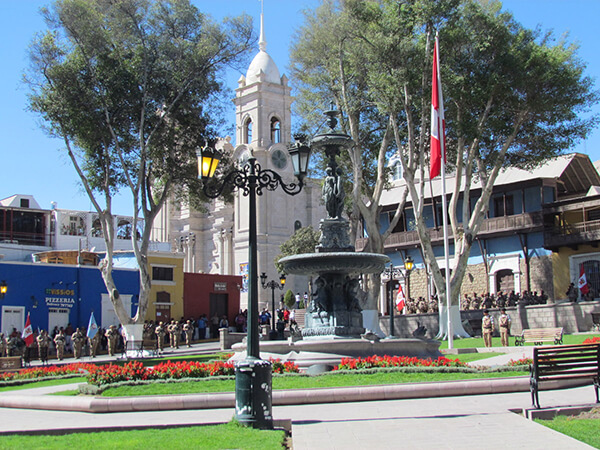
Moquegua, founded by the Spanish colonists as Villa de Santa Catalina de Guadalcázar del Valle de Moquegua) is a city in southern Peru, located in the Moquegua Region, of which it is the capital. It is also capital of Mariscal Nieto Province and Moquegua District. It is located 1144 kilometers south of the capital city of Lima.
This region was occupied for thousands of years by successive cultures of indigenous peoples. The Wari culture built numerous monuments, and developed terraced fields to support crop cultivation on hillsides hundreds of years before the Inca conquered them and expanded their territory into this area. Cerro Baúl is the remains of a Wari monumental site, on top of a hill outside of Moquegua.
According to Inca Garcilaso de la Vega, the Inca Emperor Mayta Cápac organized the military expedition that extended the Inca domains to the shore of the Pacific. They overcame other indigenous peoples in the 15th century; in the next century, they were conquered by the Spanish.
There is no definite information about the year of the city's founding by the Spanish. Tradition holds that the colonial city was founded on November 25, 1541, by Pedro Cansino and his wife Josefina de Bilbao.
Moquegua's economy is largely based on mining. Resources include copper, silver, gold and molybdenum. Cuajone and part of Toquepala Mine are located in the Mcal. Nieto Province. A copper smelter and refinery to treat copper concentrates from those mines is located in Ilo province.