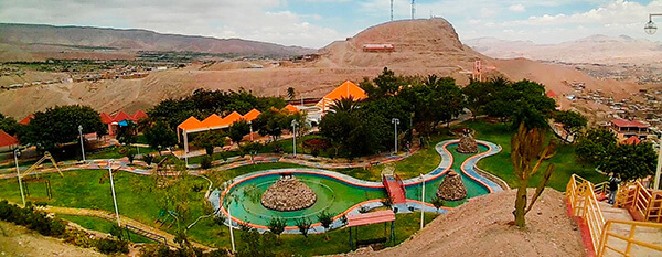
Information about the city Moquegua
Moquegua, founded by the Spanish colonists as Villa de Santa Catalina de Guadalcázar del Valle de Moquegua) is a city in southern Peru, located in the Moquegua Region, of which it is the capital. It is also capital of Mariscal Nieto Province and Moquegua District. It is located 1144 kilometers south of the capital city of Lima.
This region was occupied for thousands of years by successive cultures of indigenous peoples. The Wari culture built numerous monuments, and developed terraced fields to support crop cultivation on hillsides hundreds of years before the Inca conquered them and expanded their territory into this area. Cerro Baúl is the remains of a Wari monumental site, on top of a hill outside of Moquegua.
According to Inca Garcilaso de la Vega, the Inca Emperor Mayta Cápac organized the military expedition that extended the Inca domains to the shore of the Pacific. They overcame other indigenous peoples in the 15th century; in the next century, they were conquered by the Spanish.
There is no definite information about the year of the city's founding by the Spanish. Tradition holds that the colonial city was founded on November 25, 1541, by Pedro Cansino and his wife Josefina de Bilbao.
Moquegua's economy is largely based on mining. Resources include copper, silver, gold and molybdenum. Cuajone and part of Toquepala Mine are located in the Mcal. Nieto Province. A copper smelter and refinery to treat copper concentrates from those mines is located in Ilo province.
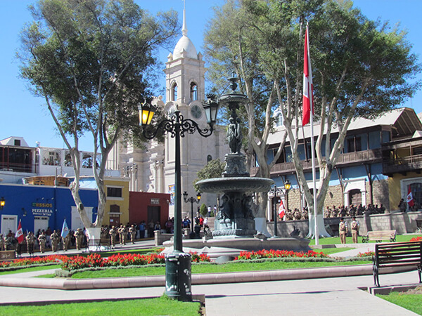
Information about the city Recuay
Recuay is a town in the Ancash Region, Peru. It is located at the border of the Santa River, 3422 msnm, and it the capital of the Recuay Province. it was created by law 11326 on April 14, 1950.
Recuay maintains its colonial style up to now, with its old casonas and simple buildings, made of mud walls and tiles roofs. Its main square has a classic fountain in the middle, surrounded with grills. From there the majestic 'hill of Jerusalem' is observed and the eucalyptuses and cypresses that adorn this city can also be admired.
It possesses the mineral waters and thermal springs of Quñuqqucha, Uqhuschaka, Pachaqutu, Pumapampa, Burgos and Utuco. The lakes named Qiruqucha and Quñuqqucha are located inside the limits of the province, as well as the magnificent Puya Raimondi forest - taking the detour towards Carpa - and the San Francisco cave, a geologic formation of volcanic rock with beautiful stalactites.
There is also another unpaved highway that joins Recuay with Aija, the homeland of the scientist Santiago Antúnez de Mayolo. It is necessary to climb the Cordillera Negra which crosses Wank'ap'iti at 4,000 msnm, and descend towards the city of Aija.
At 25 km from Recuay, penetrating the Callejón de Huaylas, Huaraz, the capital of the Ancash Region, is located. On both sides of the paved highway towards Huaraz, a big variety of typical sceneries are repeated tirelessly. From Puente Bedoya (Bedoya bridge) (km 183) starts, on the right hand, a road towards Olleros and Waripampa (Huaripampa), and the more and more journeyed walk towards Chavín