Information about the city Paita
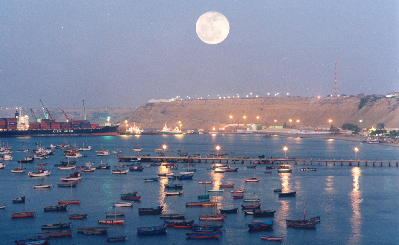
Paita is a city in northwestern Peru. It is the capital of the Paita Province which is in the Piura Region. It is a leading seaport in that region. It is located 1,089 km northwest of the country's capital Lima and 57 km northwest of the regional capital of Piura. Starting in 2014, it has entertained ideas for the separation Paita from Piura Region, proclaiming itself "Miguel Grau region".
The seaport city Paita is located at WikiMiniAtlas05°05′28″S 81°06′23″W on a small peninsula south of the mouth of the Río Chira on an area of 1,785 km². Paita faces on the Bay of Paita, and is sheltered from southerly winds by a headland called Punta Paita and by a large hill called Silla de Paita. 90 km to the south east is the capital of the Piura Region, Piura, and 160 km to the south is located Chiclayo, commercial centre of the Lambayeque region.
In 1875, a railway line of 97 km length was completed from Piura to Paita, but it was destroyed in the war with Chile from 1879 to 1883 and reconstructed in 1884. A street railway opened on 30 August 1891 and ran until the late 1920s.
Today the port of Paita is Peru's fifth largest port and an important container port. It is located in a geopolitically important position on the Pacific coast.
Paita has one of the best natural harbours of the Peruvian coast and runs regular mail steamers between Valparaíso and Panama.
Information about the city Cusco
Cusco is a city in southeastern Peru, near the Urubamba Valley of the Andes mountain range. It is the capital of the Cusco Region as well as the Cusco Province. In 2013, the city had a population of 435,114. Located on the eastern end of the Knot of Cuzco, its elevation is around 3,400 m (11,200 ft). The site was the historic capital of the Inca Empire from the 13th until the 16th-century Spanish conquest. In 1983 Cusco was declared a World Heritage Site by UNESCO. It has become a major tourist destination, hosting nearly 2 million visitors a year. The Constitution of Peru designates it as the Historical Capital of Peru.
Cusco extends throughout the Huatanay (or Watanay) river valley. Located on the eastern end of the Knot of Cusco, its elevation is around 3,400 m (11,200 ft). To its north is the Vilcabamba mountain range with 4,000–6,000-metre-high (13,000–20,000-foot) mountains. The highest peak is Salcantay (6,271 metres or 20,574 feet) about 60 kilometres (37 miles) northwest of Cusco.[23]
Cusco has a subtropical highland climate (Köppen Cwb). It is generally dry and temperate, with two defined seasons. The dry season lasts from May to August, with abundant sunshine and occasional nighttime freezes; July is the coolest month with an average of 9.7 °C (49.5 °F). The wet season lasts from December to March, with night frost less common; November averages 13.3 °C (55.9 °F). Although frost and hail are common, the only snowfall ever recorded was in June 1911. Temperatures usually range from 0.2 to 20.9 °C (32.4 to 69.6 °F), but the all-time temperature range is between −8.9 and 30 °C (16.0 and 86.0 °F). Sunshine hours peak in July; the equivalent of January in the northern hemisphere. In contrast, February, the equivalent of August in the northern hemisphere, has the least amount of sunshine.
Tourism has been the backbone of the economy starting in the early 2000s, bringing in more than 1.2 million tourists per year. In 2002, the income Cusco received from tourism was $837 million USD. In 2009, that number increased to $2.47 billion USD.