Information about the city Paita
Paita is a city in northwestern Peru. It is the capital of the Paita Province which is in the Piura Region. It is a leading seaport in that region. It is located 1,089 km northwest of the country's capital Lima and 57 km northwest of the regional capital of Piura. Starting in 2014, it has entertained ideas for the separation Paita from Piura Region, proclaiming itself "Miguel Grau region".
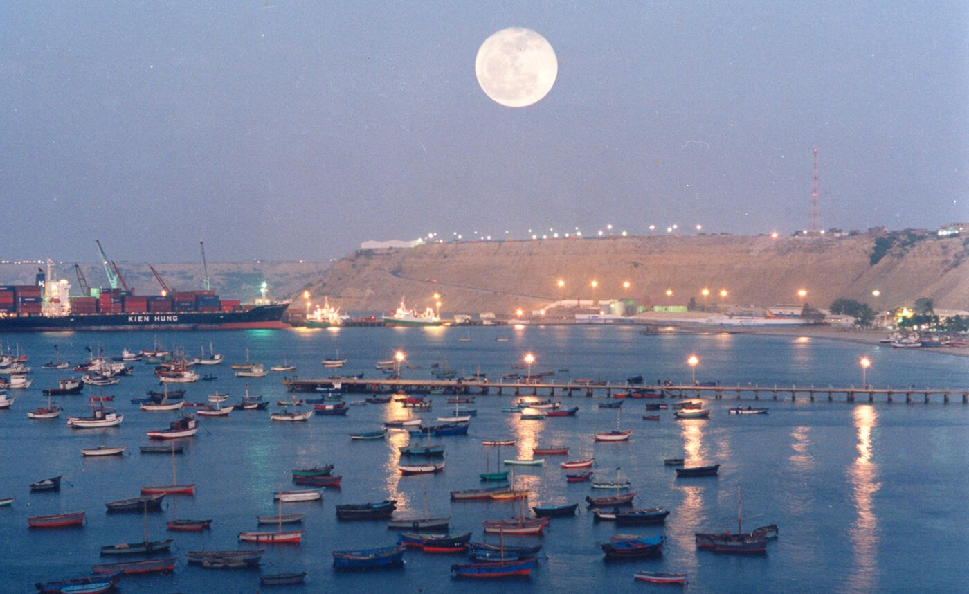
The seaport city Paita is located at WikiMiniAtlas05°05′28″S 81°06′23″W on a small peninsula south of the mouth of the Río Chira on an area of 1,785 km². Paita faces on the Bay of Paita, and is sheltered from southerly winds by a headland called Punta Paita and by a large hill called Silla de Paita. 90 km to the south east is the capital of the Piura Region, Piura, and 160 km to the south is located Chiclayo, commercial centre of the Lambayeque region.
In 1875, a railway line of 97 km length was completed from Piura to Paita, but it was destroyed in the war with Chile from 1879 to 1883 and reconstructed in 1884. A street railway opened on 30 August 1891 and ran until the late 1920s.
Today the port of Paita is Peru's fifth largest port and an important container port. It is located in a geopolitically important position on the Pacific coast.
Paita has one of the best natural harbours of the Peruvian coast and runs regular mail steamers between Valparaíso and Panama.
Information about the city La Libertad
La Libertad is a region in northwestern Peru. Formerly it was known as the Department of La Libertad (Departamento de La Libertad). It is bordered by the Lambayeque, Cajamarca and Amazonas regions on the north, the San Martín Region on the east, the Ancash and Huánuco regions on the south and the Pacific Ocean on the west. Its capital is Trujillo, which is the nation's third biggest city. The region's main port is Salaverry, one of Peru's largest ports. The name of the region is Spanish for "freedom" or "liberty"; it was named in honor of the Intendencia of Trujillo's proclaiming independence from Spain in 1820 and fighting for that.
During the viceroyalty of Peru, the La Libertad region, together with the present-day regions of Lambayeque, Piura and Tumbes regions in Peru, and Guayaquil and El Oro Province in Ecuador, were all within the jurisdiction of the Intendencía de Trujillo. These were included in the domain of the city of Trujillo; together they comprised the Departamento de Trujillo of the viceroyalty.
After the Intendencía joined the emancipation cause and was the first to gain independence from Spain, in 1825 the Congress of the Peruvian republic changed the name to Departmento de la Libertad. Since the late 20th century, Peru has decentralized its government. All former Departments in Peru are now called Regions; their governors are elected, and they have more independent authority in decisionmaking.
La Libertad is the only Peruvian region that includes all three natural regions of the nation: coast, Sierra (highlands), and selva (rainforest).
Trujillo, the capital, has a strategic location, near where the Andes come closest to the coast. Seen from Trujillo, the Andes appears as a row of low-elevation hills. The Andean Plateau increases altitude sharply to the east, in the provinces of Otuzco and Santiago de Chuco. These two provinces comprise the Pacific hydrographic watershed, which give rise to the Moche and Virú rivers, to the south, and Chicama River to the north. Pacasmayo Province, located more to the north, is along the coast. To the east, Sánchez Carrión Province waterways drain into the Amazon River and thus belong to the Atlantic Ocean watershed.