Information about the city Paita
Paita is a city in northwestern Peru. It is the capital of the Paita Province which is in the Piura Region. It is a leading seaport in that region. It is located 1,089 km northwest of the country's capital Lima and 57 km northwest of the regional capital of Piura. Starting in 2014, it has entertained ideas for the separation Paita from Piura Region, proclaiming itself "Miguel Grau region".
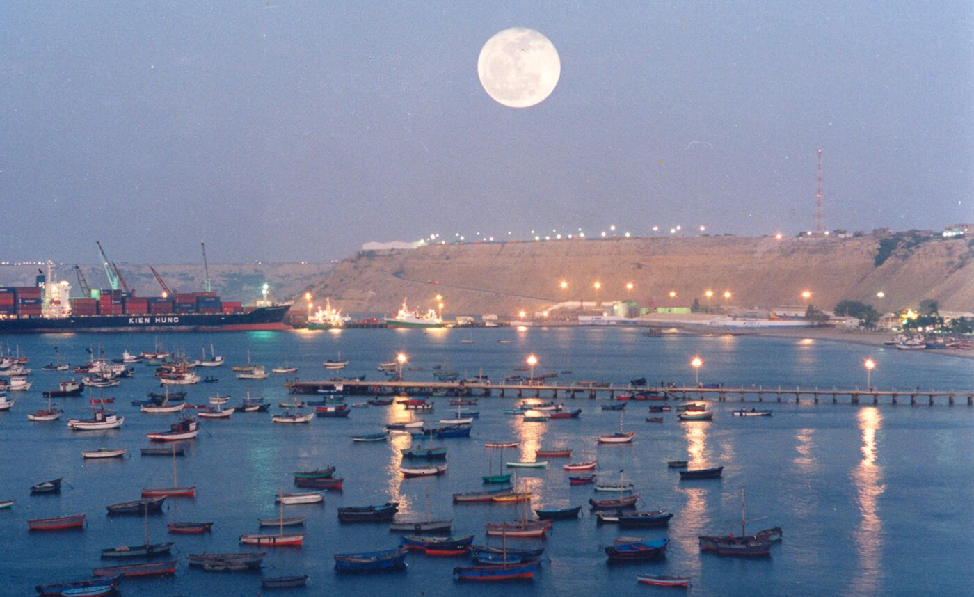
The seaport city Paita is located at WikiMiniAtlas05°05′28″S 81°06′23″W on a small peninsula south of the mouth of the Río Chira on an area of 1,785 km². Paita faces on the Bay of Paita, and is sheltered from southerly winds by a headland called Punta Paita and by a large hill called Silla de Paita. 90 km to the south east is the capital of the Piura Region, Piura, and 160 km to the south is located Chiclayo, commercial centre of the Lambayeque region.
In 1875, a railway line of 97 km length was completed from Piura to Paita, but it was destroyed in the war with Chile from 1879 to 1883 and reconstructed in 1884. A street railway opened on 30 August 1891 and ran until the late 1920s.
Today the port of Paita is Peru's fifth largest port and an important container port. It is located in a geopolitically important position on the Pacific coast.
Paita has one of the best natural harbours of the Peruvian coast and runs regular mail steamers between Valparaíso and Panama.
Information about the city Tingo María
Tingo María is the capital of Leoncio Prado Province in the Huánuco Region in central Peru. It has an urban population of around 55,000 (June 2007).
Tingo María was considered unreachable until 1936, when the Montaña Road reached the settlement. It was then that the state run Estacion Experimental Agricola was established due to its "comfortable" elevation (2,204 ft). In 1942, the U.S. Government began adding more funding to the station, and by 1960 over 40,000 acres (160 km²) of land were under cultivation, especially along the Huallaga River valley where land was level. Coffee was a particularly valuable crop. The city nickname is "the Door of the Amazonia."
The city is placed where two important rivers meet; the Monzón and the Huallaga river, a main contributor of the Marañón river. The city headquarters the National University of the Forest (UNAS-www.unas.edu.pe); it has 7 faculties, a botanical park, and first level facilities. Near the city there is the Tingo María National Park of 180 km² (43,000 acres (170 km2)) that preserves nature and a limestone mountain range in the shape of a woman that sleeps. It is called La Bella Durmiente (Spanish for Sleeping Beauty) or Pumarinri (Quechua for "cougar ear"). A legend explains the form of the range. The main attraction is a cave named Cueva de las Lechuzas (Spanish for "cave of the owls") (named after a colony of the superficially owl-like Oilbird found in it), probably the most attractive and accessible cave of Peru, though it is not the longest and deepest.
Tingo María has an airport served daily by regional jets and turbo-prop airplanes. A well-paved main road, now called "the Federico Basadre" Highway crosses the city halfway from Lima to Pucallpa; 16 km going to the east it meets the Marginal Highway that follows the river to the north and arrives at Tarapoto. A main road that comes from Casma port, on the coast of Ancash department, is being worked now. This road reinforces the position of Tingo María as a regional and national hub.
The mayor is Juan Picón Quedo, part of a local business family. A relevant industry working on Cacao is the Cooperativa Agroindustrial Naranjillo, that sells its products to foreign markets.