Information about the city Pucallpa
Pucallpa is a city in eastern Peru located on the banks of the Ucayali River, a major tributary of the Amazon River. It is the capital of the Ucayali region, the Coronel Portillo Province and the Calleria District.
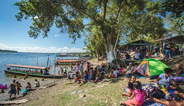
Pucallpa was founded in the 1840s by Franciscan missionaries who settled several families of the Shipibo-Conibo ethnic group. For several decades it remained a small settlement as it was isolated from the rest of the country by the Amazon Rainforest and the Andes mountain range. From the 1880s through the 1920s a railway project to connect Pucallpa with the rest of the country via the Ferrocarril Central Andino was started and dropped several times until it was finally abandoned. Pucallpa's isolation finally ended in 1945 with the completion of a highway to Lima through Tingo Maria. The highway allowed the commercialization of regional products to the rest of the country, thus improving the economic outlook of the region and its capital, Pucallpa. However, the heavy rainfalls of the Amazon Rainforest remain a problem as they erode the highway and can even undermine it by causing flash floods. Pucallpa is served by air through the Captain Rolden International Airport and by river through its port Pucallpillo near the center of the city. During the high water season, the floating ports of La Hoyada and Puerto Italia are used for riverine communications. Pucallpa is connected by road to Lima via the cities Huánuco and Cerro de Pasco. The San Lorenzo Megaport Project proposes to connect Lima with the Atlantic via a rail connection to Pucallpa and the Amazon.
Information about the city Recuay
Recuay is a town in the Ancash Region, Peru. It is located at the border of the Santa River, 3422 msnm, and it the capital of the Recuay Province. it was created by law 11326 on April 14, 1950.
Recuay maintains its colonial style up to now, with its old casonas and simple buildings, made of mud walls and tiles roofs. Its main square has a classic fountain in the middle, surrounded with grills. From there the majestic 'hill of Jerusalem' is observed and the eucalyptuses and cypresses that adorn this city can also be admired.
It possesses the mineral waters and thermal springs of Quñuqqucha, Uqhuschaka, Pachaqutu, Pumapampa, Burgos and Utuco. The lakes named Qiruqucha and Quñuqqucha are located inside the limits of the province, as well as the magnificent Puya Raimondi forest - taking the detour towards Carpa - and the San Francisco cave, a geologic formation of volcanic rock with beautiful stalactites.
There is also another unpaved highway that joins Recuay with Aija, the homeland of the scientist Santiago Antúnez de Mayolo. It is necessary to climb the Cordillera Negra which crosses Wank'ap'iti at 4,000 msnm, and descend towards the city of Aija.
At 25 km from Recuay, penetrating the Callejón de Huaylas, Huaraz, the capital of the Ancash Region, is located. On both sides of the paved highway towards Huaraz, a big variety of typical sceneries are repeated tirelessly. From Puente Bedoya (Bedoya bridge) (km 183) starts, on the right hand, a road towards Olleros and Waripampa (Huaripampa), and the more and more journeyed walk towards Chavín