Information about the city Puerto Maldonado
Puerto Maldonado is a city in southeastern Peru in the Amazon rainforest 55 kilometres (34 mi) west of the Bolivian border; located at the confluence of the Tambopata and Madre de Dios rivers, the latter of which joins the Madeira River as a tributary of the Amazon. It is the capital of the Madre de Dios Region.
Nearby are the Manú National Park, Tambopata National Reserve, and Bahuaja-Sonene National Park, which have been established to protect natural resources. These are some of the most pristine primary rain forests in the world. They include several oxbow lakes and clay licks, where hundreds of birds, including macaws, feed on clay.
Puerto Maldonado is in the tropical Amazon Basin. The climate is hot and humid at all times. The average annual temperature is 26 °C (79 °F) with the months of August and September being the hottest. Annual rainfall exceeds 1,000 millimetres (3.3 ft). The wet season is from October to April. The main part of the town is located on a slightly elevated area that does not normally flood in the wet season. Road travel often becomes impossible during this time. A low season occurs between June and August.
The chief industries in Puerto Maldonado are logging, artisanal small-scale gold mining,[8] Brazil nut collecting, boat building and eco-tourism. The area is virtually logged out; only one mill remains. The area was exploited for rubber in the late 19th-century and early 20th-century rubber boom, but South American production was undercut by the industry developed in southeast Asia. Rubber collection has long since ended.
At least 30,000 gold miners are active in the region around Puerto Maldonado.[8] Legislation in the European Union in the 21st century resulted in putting hundreds of Brazil nut collectors out of work, together with the crew of the associated local factory, as it raised tariffs against the product.
Tourism and related boat construction are currently the major sources of income in the economy. There are several tourist eco-lodges around Puerto Maldonado and in the reserves.
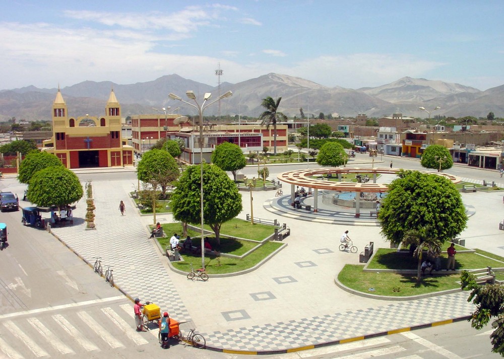
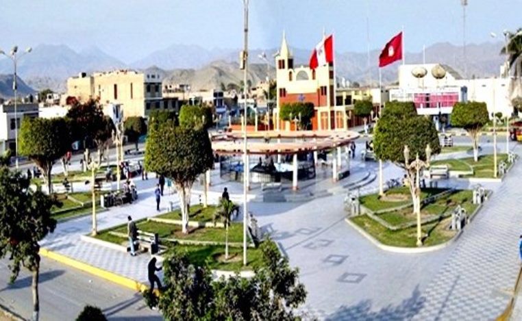
Information about the city Huarmey
Huarmey is a coastal town in the Ancash Region, Peru. It is one of the five districts and also the capital of the Province of Huarmey. It is located crossing the Pan-American highway from south to north after leaving the department of Lima in Paramonga and at 82 km from the Fortaleza river. It was created by law 24034 on December 20, 1984.
At certain times of the year, the settlers fish abundant and flavorful shrimps in the Huarmey River. This river fertilizes the valley and flows from south to north.
The port of Huarmey is located at 5 km to the south, through a detour that begins in the Pan-American highway.
From Huarmey to the next important city, Casma, there are 83 km of distance.
This city is not very well developed yet, but it is one of the main cities of the Ancash Region and one of the most impressively attractive too. Huarmey has its own beautiful beaches that do not have anything to envy to the other beaches of the country. It is a very nice place to camp, practice surf or just take a refreshing splash in its beaches. The most important disadvantage is that the water is very cold, in spite of the high temperatures of the city, all the year round.
Huarmey is the site of the Punta Lobos massacre, a 14th-century pre-Columbian Chimú human sacrifice and mass burial site.