Information about the city Recuay
Recuay is a town in the Ancash Region, Peru. It is located at the border of the Santa River, 3422 msnm, and it the capital of the Recuay Province. it was created by law 11326 on April 14, 1950.
Recuay maintains its colonial style up to now, with its old casonas and simple buildings, made of mud walls and tiles roofs. Its main square has a classic fountain in the middle, surrounded with grills. From there the majestic 'hill of Jerusalem' is observed and the eucalyptuses and cypresses that adorn this city can also be admired.
It possesses the mineral waters and thermal springs of Quñuqqucha, Uqhuschaka, Pachaqutu, Pumapampa, Burgos and Utuco. The lakes named Qiruqucha and Quñuqqucha are located inside the limits of the province, as well as the magnificent Puya Raimondi forest - taking the detour towards Carpa - and the San Francisco cave, a geologic formation of volcanic rock with beautiful stalactites.
There is also another unpaved highway that joins Recuay with Aija, the homeland of the scientist Santiago Antúnez de Mayolo. It is necessary to climb the Cordillera Negra which crosses Wank'ap'iti at 4,000 msnm, and descend towards the city of Aija.
At 25 km from Recuay, penetrating the Callejón de Huaylas, Huaraz, the capital of the Ancash Region, is located. On both sides of the paved highway towards Huaraz, a big variety of typical sceneries are repeated tirelessly. From Puente Bedoya (Bedoya bridge) (km 183) starts, on the right hand, a road towards Olleros and Waripampa (Huaripampa), and the more and more journeyed walk towards Chavín
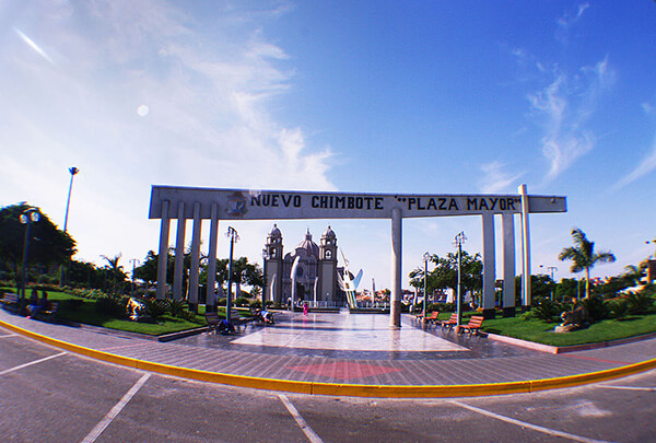
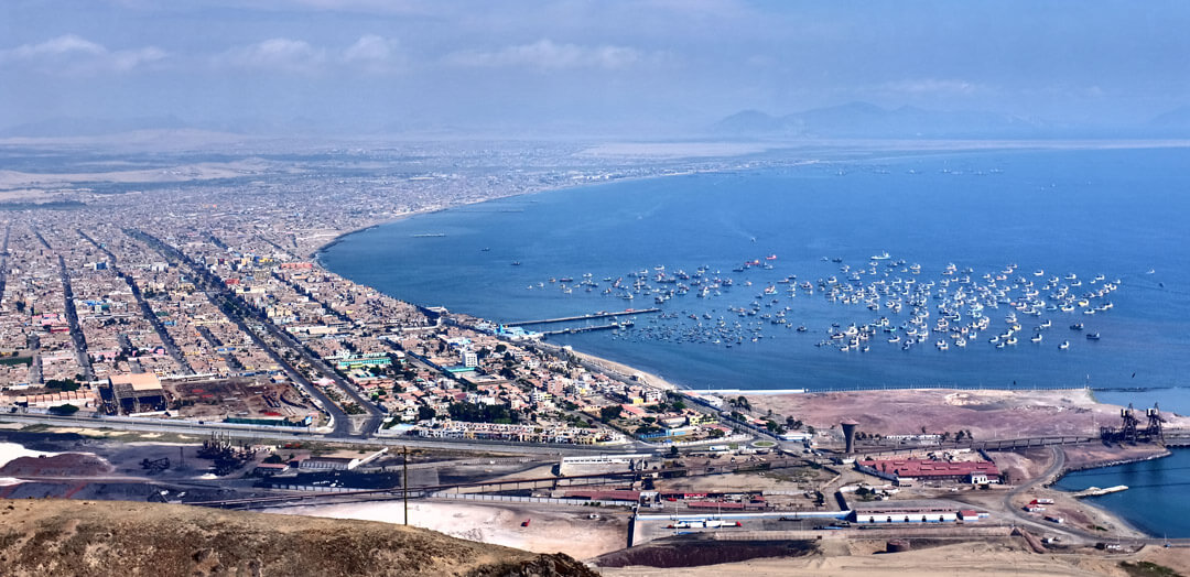
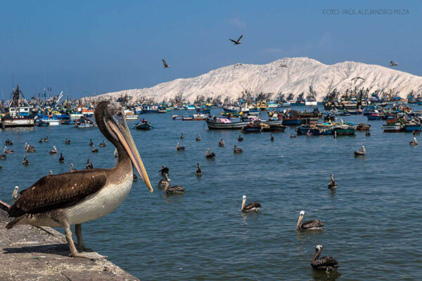
Information about the city Chimbote
Chimbote is the largest city in the Ancash Region of Peru, and the capital of both Santa Province and Chimbote District.
The city is located on the coast in Chimbote Bay, 130 km south of Trujillo and 420 kilometers (260 mi) north of Lima on the North Pan-American highway. It is the start of a chain of important cities on the Peruvian north coast like Trujillo, Chiclayo and Piura. The advantages of this geographic location made Chimbote into a transshipment junction for the Santa River valley.
In 1835, when General Santa Cruz granted Chimbote's first official acknowledgement, Chimbote was a village of fishermen with a population of no more than 800.
In 1871, an agreement was made with Henry Meiggs to build a railroad towards the interior of the country. Chimbote was classified as a port, even though its population remained around 1,000. The opening of the Pan-American Highway created easy access to Lima in the 1930s. In 1881, there was an attempt to cede a naval base to the U.S. in Chimbote Bay by Peru. The deal was blocked by Chile who sent its marines to occupy Chimbote after learning of the deal to cede a naval base to the U.S. Navy.
In 1940, Chimbote was still a small fishing port, with only 2,400 inhabitants in an urbanized area of 80 hectares (0.80 km2; 0.31 sq mi). In 1943, the government created the Corporación Peruana del Santa (Peruvian Corporation of Santa). This entity assumed ownership of the railroad, made improvements to the port, and began work on a hydroelectric power station on the Río Santa (in the Cañón del Pato [Duck Canyon] in Huallanca). The first stage of the power station was inaugurated in 1958; also that year, an iron and steel plant was built. By 1943, the first companies dedicated to the extraction of liver from the Pacific bonito fish arrived. This liver was sold for a high price abroad due to World War II.