Information about the city Recuay
Recuay is a town in the Ancash Region, Peru. It is located at the border of the Santa River, 3422 msnm, and it the capital of the Recuay Province. it was created by law 11326 on April 14, 1950.
Recuay maintains its colonial style up to now, with its old casonas and simple buildings, made of mud walls and tiles roofs. Its main square has a classic fountain in the middle, surrounded with grills. From there the majestic 'hill of Jerusalem' is observed and the eucalyptuses and cypresses that adorn this city can also be admired.
It possesses the mineral waters and thermal springs of Quñuqqucha, Uqhuschaka, Pachaqutu, Pumapampa, Burgos and Utuco. The lakes named Qiruqucha and Quñuqqucha are located inside the limits of the province, as well as the magnificent Puya Raimondi forest - taking the detour towards Carpa - and the San Francisco cave, a geologic formation of volcanic rock with beautiful stalactites.
There is also another unpaved highway that joins Recuay with Aija, the homeland of the scientist Santiago Antúnez de Mayolo. It is necessary to climb the Cordillera Negra which crosses Wank'ap'iti at 4,000 msnm, and descend towards the city of Aija.
At 25 km from Recuay, penetrating the Callejón de Huaylas, Huaraz, the capital of the Ancash Region, is located. On both sides of the paved highway towards Huaraz, a big variety of typical sceneries are repeated tirelessly. From Puente Bedoya (Bedoya bridge) (km 183) starts, on the right hand, a road towards Olleros and Waripampa (Huaripampa), and the more and more journeyed walk towards Chavín
Information about the city Paita
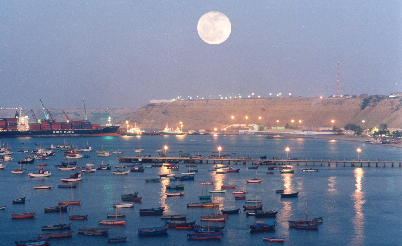
Paita is a city in northwestern Peru. It is the capital of the Paita Province which is in the Piura Region. It is a leading seaport in that region. It is located 1,089 km northwest of the country's capital Lima and 57 km northwest of the regional capital of Piura. Starting in 2014, it has entertained ideas for the separation Paita from Piura Region, proclaiming itself "Miguel Grau region".
The seaport city Paita is located at WikiMiniAtlas05°05′28″S 81°06′23″W on a small peninsula south of the mouth of the Río Chira on an area of 1,785 km². Paita faces on the Bay of Paita, and is sheltered from southerly winds by a headland called Punta Paita and by a large hill called Silla de Paita. 90 km to the south east is the capital of the Piura Region, Piura, and 160 km to the south is located Chiclayo, commercial centre of the Lambayeque region.
In 1875, a railway line of 97 km length was completed from Piura to Paita, but it was destroyed in the war with Chile from 1879 to 1883 and reconstructed in 1884. A street railway opened on 30 August 1891 and ran until the late 1920s.
Today the port of Paita is Peru's fifth largest port and an important container port. It is located in a geopolitically important position on the Pacific coast.
Paita has one of the best natural harbours of the Peruvian coast and runs regular mail steamers between Valparaíso and Panama.